
el Tarter topographic map
Interactive map
Click on the map to display elevation.
About this map
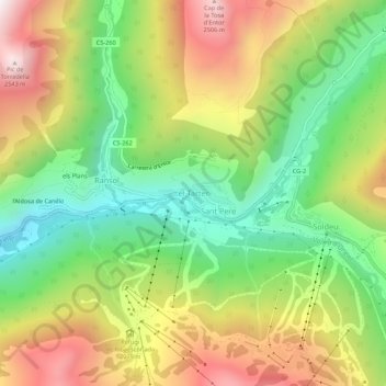
Name: el Tarter topographic map, elevation, terrain.
Location: el Tarter, Canillo, AD100, Andorra (42.56033 1.62970 42.60033 1.66970)
Average elevation: 2,014 m
Minimum elevation: 1,586 m
Maximum elevation: 2,558 m
Other topographic maps
Click on a map to view its topography, its elevation and its terrain.