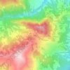
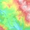
Trebbia topographic map
Click on the map to display elevation.
Trebbia
Judging from the archaeological evidence, the Trebbia valley has been continuously occupied since the end of the Acheulian in the Paleolithic, about 150000 years ago. In the Mesolithic various summer camps for high-altitude hunting were located in the valley. Neolithic cultures were at first diverse (4500 BC). Later in the Neolithic, at about 4000 BC, the Square-mouthed pottery culture began to prevail; at about 3000 BC, the Chassey-Lagozza culture of the Chalcolithic. The Bronze Age population resided in settlements located at positions with natural defenses. Etruscan elements began in the Iron Age, about the 5th century BC. Celtic artifacts immediately preceded the Roman presence.
About this map

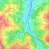
Name: Trebbia topographic map, elevation, terrain.
Location: Trebbia, Emilia-Romagna, Italy (44.50747 9.17173 45.07524 9.68662)
Average elevation: 571 m
Minimum elevation: 41 m
Maximum elevation: 1,786 m
Other topographic maps
Click on a map to view its topography, its elevation and its terrain.

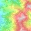
Casale-San Vito
Italy > Emilia-Romagna > Rimini > Santarcangelo di Romagna > San Vito
Average elevation: 25 m










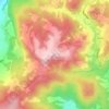
Masdone
Italy > Emilia-Romagna > Parma > Lesignano de' Bagni > Lesignano de' Bagni
Average elevation: 252 m


Monte Cimone
Italy > Emilia-Romagna > Modena > Fiumalbo
The mountain has an elevation of 2,165 m and is also the highest point in the Emilia-Romagna region of Italy.
Average elevation: 1,759 m










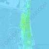
San Vitale Grande
Italy > Emilia-Romagna > Bologna > Calderara di Reno > Lippo
Average elevation: 33 m

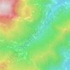
Possessione Piccola
Italy > Emilia-Romagna > Bologna > San Giovanni in Persiceto
Average elevation: 25 m

Terminaccio
Italy > Emilia-Romagna > Reggio nell'Emilia > Castelnovo ne' Monti > Garfagnolo
Average elevation: 706 m