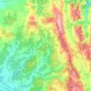
Pyrenees topographic map
Click on the map to display elevation.
Pyrenees
The Pyrenees (/ˈpɪrɪniːz/; Spanish: Pirineos [piɾiˈneos]; French: Pyrénées [piʁene] (listen); Catalan: Pirineu [piɾiˈnɛw]; Basque: Pirinioak [piɾini.o.ak]; Occitan: Pirenèus [piɾeˈnɛws]; Aragonese: Pirineus) is a mountain range straddling the border of France and Spain. It extends nearly 500 km (310 mi) from its union with the Cantabrian Mountains to Cap de Creus on the Mediterranean coast. It reaches a maximum altitude of 3,404 metres (11,168 ft) at the peak of Aneto.
About this map
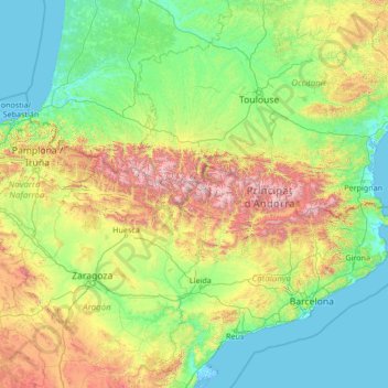
Name: Pyrenees topographic map, elevation, terrain.
Location: Pyrenees, Spain (41.72777 -2.07642 43.39906 3.32224)
Average elevation: 491 m
Minimum elevation: -4 m
Maximum elevation: 3,311 m
Other topographic maps
Click on a map to view its topography, its elevation and its terrain.
Majorca
Mallorca and the other Balearic Islands are geologically an extension of the fold mountains of the Betic Cordillera of Andalusia. They consist primarily of sediments deposited in the Tethys Sea during the Mesozoic era. These marine deposits have given rise to calcareous rocks which are often fossiliferous. The…
Average elevation: 61 m
Madrid
Madrid lies in the centre of the Iberian peninsula on the southern Meseta Central, 60 km south of the Guadarrama mountain range and straddling the Jarama and Manzanares river sub-drainage basins, in the wider Tagus River catchment area. With an average altitude of 650 metres (2,130 ft), Madrid is the second…
Average elevation: 671 m
Gran Canaria
Gran Canaria is located in the Atlantic Ocean in a region known as Macaronesia about 150 kilometres (93 mi) off the northwestern coast of Africa and about 1,350 km (840 mi) from Europe. With an area of 1,560 km2 (602 sq. mi) and an altitude of 1,956 m (6,417 ft) at Morro de la Agujereada, Gran Canaria is the…
Average elevation: 335 m
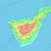
Tenerife
Teide National Park, located in the center of the island, is also a UNESCO World Heritage Site. It includes Mount Teide, which has the highest elevation in Spain, and the highest among all the islands in the Atlantic Ocean. It is also the third-largest volcano in the world, when measured from its base. Another…
Average elevation: 281 m
Granada
Spain > Andalusia > Comarca de la Vega de Granada
Granada (Spanish: [ɡɾaˈnaða], locally [ɡɾaˈna]) is the capital city of the province of Granada, in the autonomous community of Andalusia, Spain. Granada is located at the foot of the Sierra Nevada mountains, at the confluence of four rivers, the Darro, the Genil, the Monachil and the Beiro. Ascribed to…
Average elevation: 829 m
Valencia
Spain > Valencian Community > Comarca de València
The maximum of precipitation occurs in the Autumn, coinciding with the time of the year when cold drop (gota fría) episodes of heavy rainfall—associated to cut-off low pressure systems at high altitude— are common along the Western mediterranean coast. The year-on-year variability in precipitation may be,…
Average elevation: 37 m
Bilbao
Spain > Basque Country > Bilbao
Bilbao is situated in the north-central part of Spain, some 16 kilometres (10 mi) south of the Bay of Biscay, where the economic social development is located, where the estuary of Bilbao is formed. Its main urban core is surrounded by two small mountain ranges with an average elevation of 400 metres (1,300…
Average elevation: 156 m
Seville
Seville has an area of 141 km2 (54 sq mi), according to the National Topographic Map (Mapa Topográfico Nacional) series from the Instituto Geográfico Nacional – Centro Nacional de Información Geográfica, the country's civilian survey organisation (pages 984, 985 and 1002). The city is situated in the…
Average elevation: 35 m
Andalusia
Andalusia sits at a latitude between 36° and 38° 44' N, in the warm-temperate region. In general, it experiences a hot-summer Mediterranean climate, with dry summers influenced by the Azores High, but subject to occasional torrential rains and extremely hot temperatures. In the winter, the tropical…
Average elevation: 378 m
San Pedro del Pinatar
Spain > Region of Murcia > Campo de Cartagena y Mar Menor
Average elevation: 14 m


Canary Islands
The Canary Islands, especially Tenerife, Gran Canaria, Fuerteventura, and Lanzarote, are a major tourist destination, with over 12 million visitors per year. This is due to their beaches, subtropical climate, and important natural attractions, especially Maspalomas in Gran Canaria, Teide National Park, and…
Average elevation: 16 m
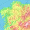
Galicia
The interior of Galicia is characterized by a hilly landscape; mountain ranges rise to 2,000 m (6,600 ft) in the east and south. The coastal areas are mostly an alternate series of rias and beaches. The climate of Galicia is usually temperate and rainy, with markedly drier summers; it is usually classified as…
Average elevation: 456 m
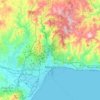
Málaga
Spain > Andalusia > Málaga-Costa del Sol
Like many of the military fortifications that were constructed in Islamic Spain, the Alcazaba of Málaga featured a quadrangular plan. It was protected by an outer and inner wall, both supported by rectangular towers, between which a covered walkway led up the slope to the Gibralfaro (this was the only…
Average elevation: 276 m
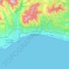
Marbella
Spain > Andalusia > Costa del Sol Occidental
There are five geomorphological units: the Sierra Blanca, the Sierra Blanca piedmont (foothills), the lower hill country, the plains and the coastal dunes. The Sierra Blanca is most centrally located in the province, looming over the old village. This mountain range has three peaks: La Concha, located further…
Average elevation: 216 m
San Pedro del Pinatar
Spain > Region of Murcia > Campo de Cartagena y Mar Menor
Average elevation: 14 m
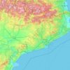
Catalonia
In the Mediterranean area, summers are dry and hot with sea breezes, and the maximum temperature is around 26–31 °C (79–88 °F). Winter is cool or slightly cold depending on the location. It snows frequently in the Pyrenees, and it occasionally snows at lower altitudes, even by the coastline. Spring and…
Average elevation: 559 m
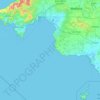
Palma de Mallorca
Spain > Balearic Islands > Palma
Palma is a major city and seaport located in the southwest of Mallorca, a western Mediterranean island belonging to the Balearic Islands archipelago. The land area of the city is about 21.355 square kilometres (8.245 sq mi) with an altitude of 13 metres (43 feet) above sea level.
Average elevation: 49 m
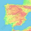
Iberian Peninsula
The Iberian Peninsula encompasses 583,254 km2 and has very contrasting and uneven relief. The mountain ranges of the Iberian Peninsula are mainly distributed from west to east, and in some cases reach altitudes of approximately 3000 mamsl, resulting in the region having the second highest mean altitude (637…
Average elevation: 351 m
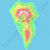
La Palma
In a programme transmitted by the British Broadcasting Corporation BBC Horizon broadcast on 12 October 2000, two geologists (Day and McGuire) cited La Grieta as proof that half of the Cumbre Vieja had moved towards the Atlantic Ocean (Day et al. 1999, and Ward and Day, 2001). They postulate that this process…
Average elevation: 296 m
Sabiñánigo
Spain > Aragon > Alto Gállego
Sabiñánigo (Samianigo in Aragonese) is a municipality located in the province of Huesca, Aragón, Spain, capital of the comarca of Alto Gállego. Formerly, the region was called Serrablo, hence the demonym "serrablese". Sabiñánigo is at an altitude of 780 m and lies 52 km from Huesca.
Average elevation: 1,211 m
Valencia
Spain > Valencian Community > Comarca de València
The maximum of precipitation occurs in the Autumn, coinciding with the time of the year when cold drop (gota fría) episodes of heavy rainfall—associated to cut-off low pressure systems at high altitude— are common along the Western mediterranean coast. The year-on-year variability in precipitation may be,…
Average elevation: 37 m
Basque Country
The Basque Country region is dominated by a warm, humid and wet oceanic climate. The coastal area is part of Green Spain and by extension, the climate is similary for Bayonne and Biarritz as well. Inland areas in Navarre and the southern regions of the autonomous community are transitional, with continental…
Average elevation: 560 m


Montoro
The altitude varies between 782 meters on Cerro de Brezorrubios, in the mountain area, and 143 meters on the banks of the Guadalquivir River. The countryside, south of the river, reaches 335 meters The town is located on a hill, 195 meters above sea level.
Average elevation: 395 m


Estepona
Spain > Andalusia > Costa del Sol Occidental
Estepona (Spanish pronunciation: [esteˈpona]) is a town and municipality in the comarca of the Costa del Sol, southern Spain. It is located in the province of Málaga, part of the autonomous community of Andalusia. Its district covers an area of 137 square kilometers in a fertile valley crossed by small…
Average elevation: 265 m
Valladolid
Valladolid is located at roughly 735 metres above sea level, at the centre of the Meseta Norte, the plateau drained by the Duero river basin covering a major part of the Northwest of the Iberian Peninsula. The primitive urban core was built ex novo in the 11th century on a small elevation near the confluence…
Average elevation: 768 m
Vigo
Vigo has a transitional climate between the oceanic climate "Cfb" and the warm-summer Mediterranean climate "Csb" according to the Köppen climate classification. Although Vigo is the rainiest city in Galicia, with its noticeable drying trend in the summer, Vigo's climate is more similar to the variant of the…
Average elevation: 121 m


La Marina
Spain > Valencian Community > el Baix Segura / La Vega Baja > Guardamar del Segura
Average elevation: 7 m
Zaragoza
On 1 January 2019 the population of the city of Zaragoza was 706,904, within its administrative limits on a land area of 1,062.64 square kilometres (410.29 square miles), ranking fifth in Spain. It is the 32nd most populous municipality in the European Union. The population of the metropolitan area was…
Average elevation: 701 m
Picos de Europa
The Picos de Europa ("Peaks of Europe", also the Picos) are a mountain range extending for about 20 km (12 mi), forming part of the Cantabrian Mountains in northern Spain. The range is situated in the Autonomous Communities of Asturias, Cantabria and Castile and León. The highest peak is Torre de Cerredo, at…
Average elevation: 2,290 m




Madrid
Madrid lies in the centre of the Iberian peninsula on the southern Meseta Central, 60 km south of the Guadarrama mountain range and straddling the Jarama and Manzanares river sub-drainage basins, in the wider Tagus River catchment area. With an average altitude of 650 metres (2,130 ft), Madrid is the second…
Average elevation: 671 m
Majorca
Mallorca and the other Balearic Islands are geologically an extension of the fold mountains of the Betic Cordillera of Andalusia. They consist primarily of sediments deposited in the Tethys Sea during the Mesozoic era. These marine deposits have given rise to calcareous rocks which are often fossiliferous. The…
Average elevation: 61 m



Trebujena
Spain > Andalusia > Northwest Coast
As at 1 January 2015 it had 7,072 inhabitants. Its surface area is 70 km² and has a density of 101.27 people / km². It is located at an altitude of 69 meters and 57 kilometers from the provincial capital, Cadiz. The neighboring towns are Jerez de la Frontera and Sanlúcar de Barrameda in the province of…
Average elevation: 12 m
Jaca
Jaca has a submediterranean climate (Köppen: Cfb) bordering a submediterranean climate (Köppen: Cfa) with strong continental influences caused by the city's high altitude of 820 metres (2,690 ft). Winters are cool and summers are warm, with hot daytime temperatures but relatively cool nights. There isn't any…
Average elevation: 1,223 m