Geolocate

Zinz topographic map

Interactive map

Click on the map to display elevation.

About this map

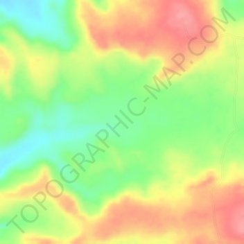
Name: Zinz topographic map, elevation, terrain.

Location: Zinz, North Shewa (Amhara Region), Amhara, Éthiopie (10.34000 39.50667 10.36000 39.52667)

Average elevation: 2,869 m

Minimum elevation: 2,814 m

Maximum elevation: 2,916 m

Other topographic maps

Click on a map to view its topography, its elevation and its terrain.

Amba Dinai

Éthiopie > Amhara

Amba Dinai, Nord Gondar, Amhara, Éthiopie

Average elevation: 1,892 m

Tilili

Éthiopie > Amhara

Tilili, Agew Awi, Amhara, Éthiopie

Average elevation: 2,456 m

Ankober

Éthiopie > Amhara

Ankober, North Shewa (Amhara Region), Amhara, Éthiopie

Average elevation: 2,672 m

Bahir Dar zone spéciale

Éthiopie > Amhara

Bahir Dar zone spéciale, Amhara, Éthiopie

Average elevation: 1,794 m

Kelela

Éthiopie > Amhara > Kelela

Kelela, Nord Gondar, Amhara, Éthiopie

Average elevation: 870 m

North Shewa (Amhara Region)

Éthiopie > Amhara

North Shewa (Amhara Region), Amhara, Éthiopie

Average elevation: 1,808 m

Gondar

Éthiopie > Amhara

Gondar, Nord Gondar, Amhara, 6200, Éthiopie

Average elevation: 2,213 m

Nord Gondar

Éthiopie > Amhara

Nord Gondar, Amhara, 6200, Éthiopie

Average elevation: 1,440 m

Lalibela

Éthiopie > Amhara

Lalibela, ሰሜን ወሎ, Amhara, 6500, Éthiopie

Average elevation: 2,426 m

Lac Tana

Éthiopie > Amhara

Lac Tana, Amhara, Éthiopie

Average elevation: 1,829 m