
Tilili topographic map
Interactive map
Click on the map to display elevation.
About this map
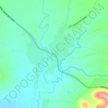
Name: Tilili topographic map, elevation, terrain.
Location: Tilili, Agew Awi, Amhara, Éthiopie (10.83335 37.00204 10.87335 37.04204)
Average elevation: 2,456 m
Minimum elevation: 2,396 m
Maximum elevation: 2,678 m
Other topographic maps
Click on a map to view its topography, its elevation and its terrain.
Bahir Dar zone spéciale
Bahir Dar zone spéciale, Amhara, Éthiopie
Average elevation: 1,794 m
North Shewa (Amhara Region)
North Shewa (Amhara Region), Amhara, Éthiopie
Average elevation: 1,808 m