
淮河街道 topographic map
Interactive map
Click on the map to display elevation.
About this map
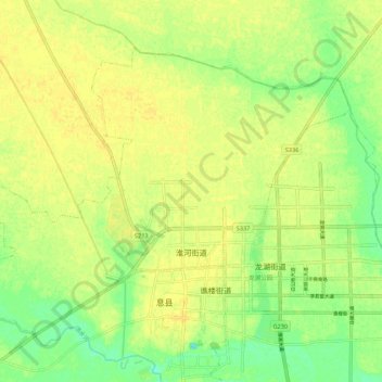
Name: 淮河街道 topographic map, elevation, terrain.
Location: 淮河街道, 息县, 信阳市, 河南省, 中国 (32.33887 114.67159 32.40806 114.78034)
Average elevation: 49 m
Minimum elevation: 35 m
Maximum elevation: 56 m
Other topographic maps
Click on a map to view its topography, its elevation and its terrain.