
Cenang Beach topographic map
Interactive map
Click on the map to display elevation.
About this map
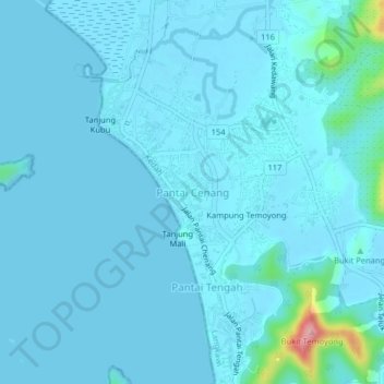
Name: Cenang Beach topographic map, elevation, terrain.
Location: Cenang Beach, Langkawi, Kedah, 07100, Malaysia (6.27134 99.70894 6.31134 99.74894)
Average elevation: 11 m
Minimum elevation: -1 m
Maximum elevation: 155 m
Other topographic maps
Click on a map to view its topography, its elevation and its terrain.
Kampung Baru Bagan Samak
Malaysia > Kedah > Permatang Kerat Telunjuk > Kampung Baru Bagan Samak
Average elevation: 3 m
Kemajuan Tanah (FELDA) Lubok Merbau
Malaysia > Kedah > Kemajuan Tanah (FELDA) Lubok Merbau
Average elevation: 60 m