
三俣蓮華岳 topographic map
Interactive map
Click on the map to display elevation.
About this map
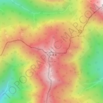
Name: 三俣蓮華岳 topographic map, elevation, terrain.
Location: 三俣蓮華岳, 富山市, 富山県, 日本 (36.38997 137.58768 36.39007 137.58778)
Average elevation: 2,487 m
Minimum elevation: 2,011 m
Maximum elevation: 2,877 m
三俣蓮華岳(みつまたれんげだけ)は飛騨山脈にある標高2,841mの山。古くは立山七十二峰の1つに数えられてきた。山域は中部山岳国立公園に指定されている。日本三百名山に選定されている。
Other topographic maps
Click on a map to view its topography, its elevation and its terrain.