
水晶岳 topographic map
Interactive map
Click on the map to display elevation.
About this map
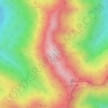
Name: 水晶岳 topographic map, elevation, terrain.
Location: 水晶岳, 富山市, 富山県, 日本 (36.42632 137.60276 36.42642 137.60286)
Average elevation: 2,567 m
Minimum elevation: 2,153 m
Maximum elevation: 2,970 m
水晶岳(すいしょうだけ)は富山市南東部に位置する標高2,986mの飛騨山脈(北アルプス)の山である。山域は中部山岳国立公園に指定され、日本百名山に選定されている。 別名は、黒岳。
Other topographic maps
Click on a map to view its topography, its elevation and its terrain.