
Guar Chempedak topographic map
Interactive map
Click on the map to display elevation.
About this map
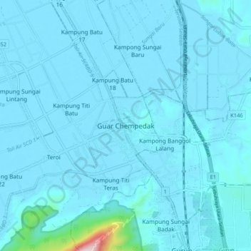
Name: Guar Chempedak topographic map, elevation, terrain.
Location: Guar Chempedak, Yan, Kedah, 08800, Malaysia (5.81853 100.41829 5.89853 100.49829)
Average elevation: 25 m
Minimum elevation: 0 m
Maximum elevation: 564 m
Other topographic maps
Click on a map to view its topography, its elevation and its terrain.
Kampung Baru Bagan Samak
Malaysia > Kedah > Permatang Kerat Telunjuk > Kampung Baru Bagan Samak
Average elevation: 3 m
Kemajuan Tanah (FELDA) Lubok Merbau
Malaysia > Kedah > Kemajuan Tanah (FELDA) Lubok Merbau
Average elevation: 60 m