
El Serrat topographic map
Interactive map
Click on the map to display elevation.
About this map
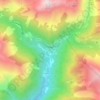
Name: El Serrat topographic map, elevation, terrain.
Location: El Serrat, Ordino, AD300, Andorra (42.59958 1.51890 42.63958 1.55890)
Average elevation: 1,995 m
Minimum elevation: 1,427 m
Maximum elevation: 2,626 m
El Serrat (Catalan pronunciation: [əl səˈrat]) is a mountain village in the parish of Ordino, Andorra. It is at an elevation of 1,540 metres (5,100 ft). It is a popular destination for skiers.[2]
Other topographic maps
Click on a map to view its topography, its elevation and its terrain.