
Bukit Payung topographic map
Interactive map
Click on the map to display elevation.
About this map
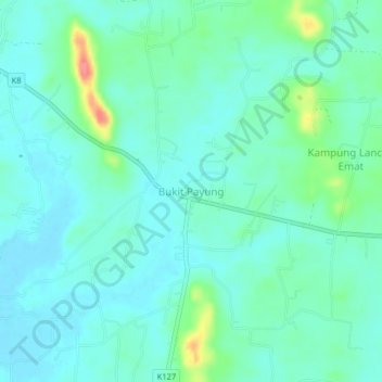
Name: Bukit Payung topographic map, elevation, terrain.
Location: Bukit Payung, Pokok Sena, Kedah, 06350, Malaysia (6.12773 100.54220 6.16773 100.58220)
Average elevation: 23 m
Minimum elevation: 7 m
Maximum elevation: 82 m
Other topographic maps
Click on a map to view its topography, its elevation and its terrain.
Kampung Baru Bagan Samak
Malaysia > Kedah > Permatang Kerat Telunjuk > Kampung Baru Bagan Samak
Average elevation: 3 m
Kemajuan Tanah (FELDA) Lubok Merbau
Malaysia > Kedah > Kemajuan Tanah (FELDA) Lubok Merbau
Average elevation: 60 m