
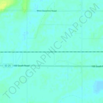
Budge topographic map
Interactive map
Click on the map to display elevation.
About this map
Name: Budge topographic map, elevation, terrain.
Location: Budge, Minidoka County, Idaho, United States (42.59880 -113.83446 42.61880 -113.81446)
Average elevation: 1,266 m
Minimum elevation: 1,262 m
Maximum elevation: 1,279 m
Other topographic maps
Click on a map to view its topography, its elevation and its terrain.
Idaho Falls
United States > Idaho > Bonneville County
Idaho Falls, Bonneville County, Idaho, United States
Average elevation: 1,441 m
Rexburg
United States > Idaho > Madison County
Rexburg, Madison County, Idaho, 83460, United States
Average elevation: 1,504 m
Coeur d'Alene
United States > Idaho > Kootenai County
Coeur d'Alene, Kootenai County, Idaho, United States
Average elevation: 719 m
Boise
United States > Idaho > Ada County
Boise, Ada County, Idaho, United States
Average elevation: 974 m
Culdesac
United States > Idaho > Nez Perce County
Culdesac, Nez Perce County, Idaho, United States
Average elevation: 588 m
South Butte
United States > Idaho > Shoshone County
South Butte, Shoshone County, Idaho, United States
Average elevation: 1,861 m
Fort Hall
United States > Idaho > Bannock County
Fort Hall, Bannock County, Idaho, United States
Average elevation: 1,377 m
South Fork Boise River
South Fork Boise River, Idaho, United States
Average elevation: 1,809 m
Priest River
United States > Idaho > Bonner County
Priest River, Bonner County, Idaho, United States
Average elevation: 742 m
Grace
United States > Idaho > Caribou County
Grace, Caribou County, Idaho, United States
Average elevation: 1,690 m
Nugget Point
United States > Idaho > Idaho County
Nugget Point, Idaho County, Idaho, United States
Average elevation: 1,659 m
Turkey Point
United States > Idaho > Shoshone County
Turkey Point, Shoshone County, Idaho, United States
Average elevation: 1,604 m
Boise
United States > Idaho > Ada County
Boise, Ada County, Idaho, 83701, United States
Average elevation: 1,040 m
McCall
United States > Idaho > Valley County
McCall, Valley County, Idaho, 83638, United States
Average elevation: 1,546 m
Blanchard
United States > Idaho > Bonner County
Blanchard, Bonner County, Idaho, 83804, United States
Average elevation: 718 m
Bayview
United States > Idaho > Kootenai County
Bayview, Kootenai County, Idaho, United States
Average elevation: 733 m
Twin Falls County
Twin Falls County, Idaho, United States
Average elevation: 1,404 m
Packsaddle Lake
United States > Idaho > Teton County
Packsaddle Lake, Teton County, Idaho, United States
Average elevation: 2,331 m
Mount Baldy
United States > Idaho > Bonneville County
Mount Baldy, Bonneville County, Idaho, United States
Average elevation: 2,089 m
Mackay
United States > Idaho > Custer County
Mackay, Custer County, Idaho, 83251, United States
Average elevation: 1,811 m
Smoky Mountain
United States > Idaho > Cassia County
Smoky Mountain, Cassia County, Idaho, United States
Average elevation: 1,976 m
Heglar
United States > Idaho > Cassia County
Heglar, Cassia County, Idaho, United States
Average elevation: 1,480 m
Box Canyon
United States > Idaho > Fremont County
Box Canyon, Fremont County, Idaho, United States
Average elevation: 1,891 m
Wheaton Mountain
United States > Idaho > Bonneville County
Wheaton Mountain, Bonneville County, Idaho, United States
Average elevation: 1,855 m
Meridian
United States > Idaho > Ada County
Meridian, Ada County, Idaho, United States
Average elevation: 802 m
Heyburn
United States > Idaho > Minidoka County
Heyburn, Minidoka County, Idaho, 83336, United States
Average elevation: 1,265 m
Athol
United States > Idaho > Kootenai County
Athol, Kootenai County, Idaho, United States
Average elevation: 733 m
Crouch
United States > Idaho > Boise County
Crouch, Boise County, Idaho, United States
Average elevation: 963 m
Grangeville
United States > Idaho > Idaho County
Grangeville, Idaho County, Idaho, United States
Average elevation: 1,037 m
Notus
United States > Idaho > Canyon County
Notus, Canyon County, Idaho, 83656, United States
Average elevation: 708 m
Orofino
United States > Idaho > Clearwater County
Orofino, Clearwater County, Idaho, 83544, United States
Average elevation: 633 m
Kellogg
United States > Idaho > Shoshone County
Kellogg, Shoshone County, Idaho, 83837, United States
Average elevation: 939 m
Lava Hot Springs
United States > Idaho > Bannock County
Lava Hot Springs, Bannock County, Idaho, 83246, United States
Average elevation: 1,611 m
tiger peak
United States > Idaho > Shoshone County
tiger peak, Shoshone County, Idaho, United States
Average elevation: 1,711 m
Lewiston
United States > Idaho > Nez Perce County
Lewiston, Nez Perce County, Idaho, 83501, United States
Average elevation: 334 m
The Maze
United States > Idaho > Idaho County
The Maze, Idaho County, Idaho, United States
Average elevation: 533 m
Middleton
United States > Idaho > Canyon County
Middleton, Canyon County, Idaho, 83644, United States
Average elevation: 741 m
Hailey
United States > Idaho > Blaine County
Hailey, Blaine County, Idaho, 83333, United States
Average elevation: 1,729 m
Kuna
United States > Idaho > Ada County
Kuna, Ada County, Idaho, 83634, United States
Average elevation: 830 m
Yellow Pine
United States > Idaho > Valley County
Yellow Pine, Valley County, Idaho, 83677, United States
Average elevation: 1,619 m
Caldwell
United States > Idaho > Canyon County
Caldwell, Canyon County, Idaho, United States
Average elevation: 742 m
Caribou-Targhee National Forest
Caribou-Targhee National Forest, Idaho, United States
Average elevation: 2,126 m