
Fort Sumter topographic map
Click on the map to display elevation.
About this map
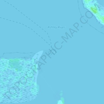
Name: Fort Sumter topographic map, elevation, terrain.
Average elevation: 0 m
Minimum elevation: -2 m
Maximum elevation: 7 m
Other topographic maps
Click on a map to view its topography, its elevation and its terrain.
Charleston
United States > South Carolina > Charleston County
Charleston is characterized by its relatively flat topography, with an average elevation of about 10 feet above sea level, making it prone to flooding during heavy rains and storms. The city is situated on a peninsula bordered by the Ashley River to the west and the Cooper River to the east, creating a natural…
Average elevation: 4 m
Mount Pleasant
United States > South Carolina > Charleston County
Mount Pleasant occupies a very low, gently undulating Lowcountry setting on the South Carolina Coastal Plain, where the town spreads across interfluves and former island-like uplands between the Cooper River, the Wando River, Charleston Harbor, Shem Creek, tidal creeks, and the Intracoastal Waterway. Its…
Average elevation: 3 m
Kiawah Island
United States > South Carolina > Charleston County
Kiawah Island features a low-lying, sandy topography typical of barrier islands along the southeastern coast of the United States. The island's average elevation is about 10 feet above sea level, with some areas reaching slightly higher. Its terrain is characterized by broad, flat beaches that gently slope…
Average elevation: 2 m
Francis Marion National Forest
United States > South Carolina > Charleston County
Average elevation: 5 m
Hobcaw Point
United States > South Carolina > Charleston County > Mount Pleasant
Average elevation: 4 m
Saint Andrews Heights
United States > South Carolina > Charleston County > Charleston
Average elevation: 5 m
Pinewood Vista
United States > South Carolina > Charleston County > North Charleston
Average elevation: 9 m
Palmetto Fort
United States > South Carolina > Charleston County > Mount Pleasant
Average elevation: 4 m
Fenwick Crossroads
United States > South Carolina > Charleston County > Charleston
Average elevation: 5 m
Jamestown Estates
United States > South Carolina > Charleston County > James Island
Average elevation: 4 m
Brook Green Meadow
United States > South Carolina > Charleston County > Mount Pleasant
Average elevation: 4 m
Hoopstick Island
United States > South Carolina > Charleston County > Johns Island
Average elevation: 4 m
Remleys Point
United States > South Carolina > Charleston County > Mount Pleasant
Average elevation: 4 m
Camp Saint Christopher
United States > South Carolina > Charleston County > Seabrook Island
Average elevation: 2 m
Hamlin Sound
United States > South Carolina > Charleston County > Mount Pleasant
Average elevation: 1 m
Mount Pleasant
United States > South Carolina > Charleston County
Mount Pleasant occupies a very low, gently undulating Lowcountry setting on the South Carolina Coastal Plain, where the town spreads across interfluves and former island-like uplands between the Cooper River, the Wando River, Charleston Harbor, Shem Creek, tidal creeks, and the Intracoastal Waterway. Its…
Average elevation: 3 m
Liberty Hill
United States > South Carolina > Charleston County > North Charleston
Average elevation: 7 m
Mount Pleasant
United States > South Carolina > Charleston County
Mount Pleasant occupies a very low, gently undulating Lowcountry setting on the South Carolina Coastal Plain, where the town spreads across interfluves and former island-like uplands between the Cooper River, the Wando River, Charleston Harbor, Shem Creek, tidal creeks, and the Intracoastal Waterway. Its…
Average elevation: 3 m
Wando Estates
United States > South Carolina > Charleston County > Mount Pleasant
Average elevation: 5 m
Forest Trail
United States > South Carolina > Charleston County > Isle of Palms
Average elevation: 1 m
Saint Andrews Heights
United States > South Carolina > Charleston County > Charleston
Average elevation: 5 m
Ashley Junction
United States > South Carolina > Charleston County > North Charleston
Average elevation: 7 m
Camp Saint Christopher
United States > South Carolina > Charleston County > Seabrook Island
Average elevation: 2 m
North Charleston
United States > South Carolina > Charleston County > North Charleston
Average elevation: 5 m
Northwood Estates
United States > South Carolina > Charleston County > North Charleston > Northwood Estates
Average elevation: 8 m
Country Club Estates
United States > South Carolina > Charleston County > Charleston
Average elevation: 3 m