
Prefectura de Kagoshima topographic map
Interactive map
Click on the map to display elevation.
About this map
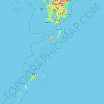
Name: Prefectura de Kagoshima topographic map, elevation, terrain.
Location: Prefectura de Kagoshima, Japón (26.83894 128.20516 32.32865 131.31591)
Average elevation: 11 m
Minimum elevation: -1 m
Maximum elevation: 1,660 m
Other topographic maps
Click on a map to view its topography, its elevation and its terrain.