
Taman Nilam topographic map
Interactive map
Click on the map to display elevation.
About this map
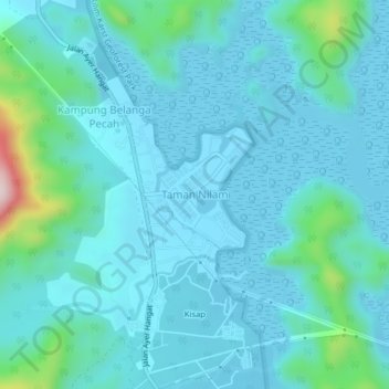
Name: Taman Nilam topographic map, elevation, terrain.
Location: Taman Nilam, Langkawi, Kedah, Malaysia (6.36043 99.84947 6.40043 99.88947)
Average elevation: 51 m
Minimum elevation: -3 m
Maximum elevation: 392 m
Other topographic maps
Click on a map to view its topography, its elevation and its terrain.
Kampung Baru Bagan Samak
Malaysia > Kedah > Permatang Kerat Telunjuk > Kampung Baru Bagan Samak
Average elevation: 3 m
Kemajuan Tanah (FELDA) Lubok Merbau
Malaysia > Kedah > Kemajuan Tanah (FELDA) Lubok Merbau
Average elevation: 60 m