
Piedralaves topographic map
Interactive map
Click on the map to display elevation.
About this map
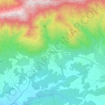
Name: Piedralaves topographic map, elevation, terrain.
Location: Piedralaves, Ávila, Castile and León, 05440, Spain (40.27353 -4.77144 40.36152 -4.66006)
Average elevation: 923 m
Minimum elevation: 458 m
Maximum elevation: 2,000 m
Other topographic maps
Click on a map to view its topography, its elevation and its terrain.
Yacimiento arqueológico La Edrada
Spain > Castile and León > El Bierzo > Cacabelos
Average elevation: 493 m
Poblado del Salto de Aldeadávila
Spain > Castile and León > Aldeadávila de la Ribera
Average elevation: 535 m
Castrillo Mota de Judíos
Spain > Castile and León > Castrillo Mota de Judíos > Castrillo Mota de Judíos
Average elevation: 801 m