
Kulim topographic map
Click on the map to display elevation.
About this map
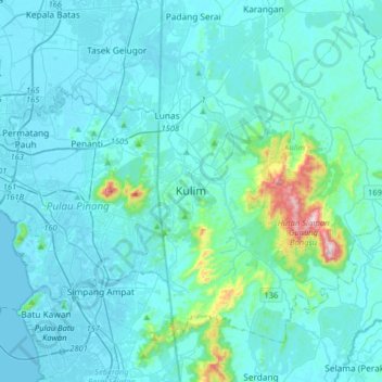
Name: Kulim topographic map, elevation, terrain.
Location: Kulim, Kedah, 09000, Malaysia (5.20638 100.39257 5.52638 100.71257)
Average elevation: 54 m
Minimum elevation: -5 m
Maximum elevation: 630 m
Other topographic maps
Click on a map to view its topography, its elevation and its terrain.
Sungai Tok Kancil
Malaysia > Kedah > Kampung Bukit Tukang Jusoh > Kampong Bukit Kechil
Average elevation: 13 m
Kemajuan Tanah (FELDA) Lubok Merbau
Malaysia > Kedah > Kemajuan Tanah (FELDA) Lubok Merbau
Average elevation: 60 m