
Damoh topographic map
Interactive map
Click on the map to display elevation.
About this map
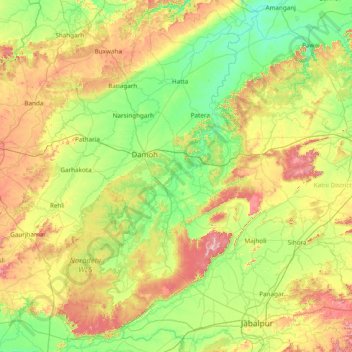
Name: Damoh topographic map, elevation, terrain.
Location: Damoh, Damoh District, Madhya Pradesh, India (23.05000 78.88333 24.45000 80.28333)
Average elevation: 410 m
Minimum elevation: 293 m
Maximum elevation: 711 m
Other topographic maps
Click on a map to view its topography, its elevation and its terrain.