
Panna topographic map
Interactive map
Click on the map to display elevation.
About this map
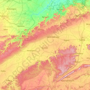
Name: Panna topographic map, elevation, terrain.
Location: Panna, Madhya Pradesh, 488058, India (23.80000 79.55000 25.20000 80.95000)
Average elevation: 336 m
Minimum elevation: 110 m
Maximum elevation: 668 m
Other topographic maps
Click on a map to view its topography, its elevation and its terrain.