
Çaycuma topographic map
Interactive map
Click on the map to display elevation.
About this map
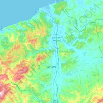
Name: Çaycuma topographic map, elevation, terrain.
Location: Çaycuma, Zonguldak, Black Sea Region, Turkey (41.33467 31.96890 41.59514 32.29470)
Average elevation: 169 m
Minimum elevation: 0 m
Maximum elevation: 893 m
Other topographic maps
Click on a map to view its topography, its elevation and its terrain.