
Bālāghāt topographic map
Interactive map
Click on the map to display elevation.
About this map
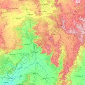
Name: Bālāghāt topographic map, elevation, terrain.
Location: Bālāghāt, Balaghat District, Madhya Pradesh, India (21.26667 79.63333 22.66667 81.03333)
Average elevation: 479 m
Minimum elevation: 246 m
Maximum elevation: 931 m
Other topographic maps
Click on a map to view its topography, its elevation and its terrain.
Shamshabad Reserved Forest
India > Madhya Pradesh > Vidisha Tahsil > Hinotiya
Average elevation: 469 m