
Guna topographic map
Interactive map
Click on the map to display elevation.
About this map
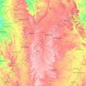
Name: Guna topographic map, elevation, terrain.
Location: Guna, Ashoknagar, Madhya Pradesh, India (23.80000 76.80000 25.20000 78.20000)
Average elevation: 435 m
Minimum elevation: 280 m
Maximum elevation: 580 m
Other topographic maps
Click on a map to view its topography, its elevation and its terrain.