
光山县 topographic map
Interactive map
Click on the map to display elevation.
About this map
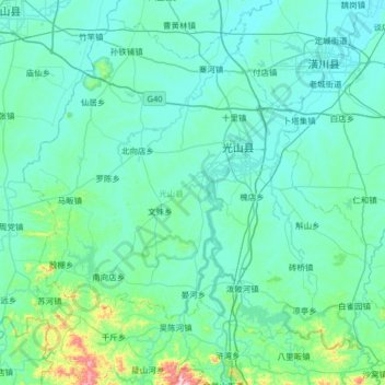
Name: 光山县 topographic map, elevation, terrain.
Location: 光山县, 信阳市, 河南省, 中国 (31.70183 114.53802 32.19329 115.18126)
Average elevation: 92 m
Minimum elevation: 32 m
Maximum elevation: 683 m
Other topographic maps
Click on a map to view its topography, its elevation and its terrain.