
磁钟乡 topographic map
Interactive map
Click on the map to display elevation.
About this map
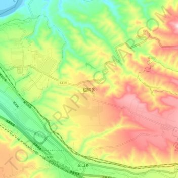
Name: 磁钟乡 topographic map, elevation, terrain.
Location: 磁钟乡, 湖滨区, 三门峡市, 河南省, 中国 (34.71620 111.23300 34.79620 111.31300)
Average elevation: 523 m
Minimum elevation: 316 m
Maximum elevation: 760 m
Other topographic maps
Click on a map to view its topography, its elevation and its terrain.