Murray County topographic map
Interactive map
Click on the map to display elevation.
About this map
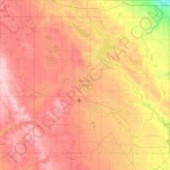
Name: Murray County topographic map, elevation, terrain.
Location: Murray County, Minnesota, United States (43.84900 -96.06532 44.19658 -95.46220)
Average elevation: 485 m
Minimum elevation: 357 m
Maximum elevation: 583 m
The county terrain consists of low rolling hills, dotted with lakes and ponds, with all available area devoted to agriculture. The terrain slopes to the south and east. However, its highest elevation occurs on Buffalo Ridge, a promontory extending about two miles along the crest of the Coteau des Prairies in central Chanarambie Township. The bluff rises a few hundred feet above the adjacent valleys. The county has a total area of 720 square miles (1,900 km2), of which 705 square miles (1,830 km2) is land and 15 square miles (39 km2) (2.1%) is water.
Other topographic maps
Click on a map to view its topography, its elevation and its terrain.
Ramsey County
Ramsey County, Minnesota, United States
Average elevation: 279 m
Franklin Township
United States > Minnesota > Wright County
Franklin Township, Wright County, Minnesota, United States
Average elevation: 290 m
Red Wing
United States > Minnesota > Goodhue County
Red Wing, Goodhue County, Minnesota, United States
Average elevation: 263 m
Gunny Sack Lake
United States > Minnesota > Itasca County
Gunny Sack Lake, Itasca County, Minnesota, United States
Average elevation: 419 m
Fred Richards Park
United States > Minnesota > Hennepin County > Edina
Fred Richards Park, Edina, Hennepin County, Minnesota, 55435, United States
Average elevation: 259 m
Wolverton WMA
United States > Minnesota > Wilkin County
Wolverton WMA, T-1, Wilkin County, Minnesota, United States
Average elevation: 284 m
Eveleth
United States > Minnesota > Saint Louis County
Eveleth, Saint Louis County, Minnesota, United States
Average elevation: 468 m
Fishing Lakes
United States > Minnesota > Saint Louis County
Fishing Lakes, Bear Head Lake, Saint Louis County, Minnesota, United States
Average elevation: 455 m
Grand Rapids
United States > Minnesota > Itasca County
Grand Rapids, Itasca County, Minnesota, 55744, United States
Average elevation: 398 m
Kasota
United States > Minnesota > Le Sueur County
Kasota, Le Sueur County, Minnesota, United States
Average elevation: 255 m
Bloomington
United States > Minnesota > Hennepin County
Bloomington, Hennepin County, Minnesota, United States
Average elevation: 255 m
Rice Lake
United States > Minnesota > Saint Louis County
Rice Lake, Saint Louis County, Minnesota, 55803, United States
Average elevation: 421 m
Dakota County
Dakota County, Minnesota, United States
Average elevation: 278 m
Chatham Township
United States > Minnesota > Wright County
Chatham Township, Wright County, Minnesota, United States
Average elevation: 302 m
Lake Itasca
United States > Minnesota > Clearwater County
Lake Itasca, Clearwater County, Minnesota, United States
Average elevation: 463 m
Wright County
Wright County, Minnesota, United States
Average elevation: 307 m
Babbitt
United States > Minnesota > Saint Louis County
Babbitt, Saint Louis County, Minnesota, United States
Average elevation: 484 m
Harmony
United States > Minnesota > Fillmore County
Harmony, Fillmore County, Minnesota, 55939, United States
Average elevation: 404 m
Eagle Creek
United States > Minnesota > Scott County
Eagle Creek, Scott County, Minnesota, United States
Average elevation: 284 m
Ormsby
United States > Minnesota > Martin County
Ormsby, Martin County, Minnesota, United States
Average elevation: 367 m
New Hope
United States > Minnesota > Hennepin County
New Hope, Hennepin County, Minnesota, 55428, United States
Average elevation: 278 m
Mankato
United States > Minnesota > Blue Earth County
Mankato, Blue Earth County, Minnesota, 56001, United States
Average elevation: 285 m
Woodbury
United States > Minnesota > Washington County
Woodbury, Washington County, Minnesota, United States
Average elevation: 297 m
Eden Prairie
United States > Minnesota > Hennepin County
Eden Prairie, Hennepin County, Minnesota, United States
Average elevation: 259 m
West Cook
United States > Minnesota > Cook County
West Cook, Cook County, Minnesota, 55604, United States
Average elevation: 501 m
Wilkin County
Wilkin County, Minnesota, United States
Average elevation: 320 m
Steele County
Steele County, Minnesota, United States
Average elevation: 370 m
St. Vincent
United States > Minnesota > Kittson County
St. Vincent, Kittson County, Minnesota, 56755, United States
Average elevation: 241 m
Dent
United States > Minnesota > Otter Tail County
Dent, Otter Tail County, Minnesota, United States
Average elevation: 416 m
Nowthen
United States > Minnesota > Anoka County
Nowthen, Anoka County, Minnesota, United States
Average elevation: 284 m
Hillman
United States > Minnesota > Morrison County
Hillman, Morrison County, Minnesota, 56338, United States
Average elevation: 400 m
Mayer
United States > Minnesota > Carver County
Mayer, Carver County, Minnesota, 55360, United States
Average elevation: 296 m
St. James
United States > Minnesota > Watonwan County
St. James, Watonwan County, Minnesota, 56081, United States
Average elevation: 328 m
Silver Bay
United States > Minnesota > Lake County
Silver Bay, Lake County, Minnesota, 55614, United States
Average elevation: 247 m
Chisago County
Chisago County, Minnesota, United States
Average elevation: 282 m
Graceville
United States > Minnesota > Big Stone County
Graceville, Big Stone County, Minnesota, 56240, United States
Average elevation: 337 m
Stearns County
Stearns County, Minnesota, United States
Average elevation: 362 m
Aitkin County
Aitkin County, Minnesota, United States
Average elevation: 385 m
Woodbury WMA
United States > Minnesota > Goodhue County > Zumbrota
Woodbury WMA, 460th Street, Zumbrota, Minneola Township, Goodhue County, Minnesota, 55946, United States
Average elevation: 341 m
Dalton
United States > Minnesota > Otter Tail County
Dalton, Otter Tail County, Minnesota, United States
Average elevation: 408 m
Natalie Webb Familly Aquatic Center
United States > Minnesota > Dodge County > Dodge Center > Valley View Park
Natalie Webb Familly Aquatic Center, 1st Avenue Northeast, Valley View Park, Dodge Center, Dodge County, Minnesota, 55927, United States
Average elevation: 384 m
Gulf of Minneapolis
United States > Minnesota > Ramsey County > Saint Paul
Gulf of Minneapolis, West Side, Saint Paul, Ramsey County, Minnesota, United States
Average elevation: 230 m
Palisade
United States > Minnesota > Aitkin County
Palisade, Aitkin County, Minnesota, United States
Average elevation: 373 m
Oneota
United States > Minnesota > Saint Louis County > Duluth
Oneota, Duluth, Saint Louis County, Minnesota, United States
Average elevation: 187 m
Duluth
United States > Minnesota > Saint Louis County
Duluth, Saint Louis County, Minnesota, United States
Average elevation: 286 m
Schroeder Township
United States > Minnesota > Cook County
Schroeder Township, Cook County, Minnesota, United States, Magic Lake
Average elevation: 564 m
Apple Valley
United States > Minnesota > Dakota County
Apple Valley, Dakota County, Minnesota, 55124, United States
Average elevation: 301 m
Milroy
United States > Minnesota > Redwood County
Milroy, Redwood County, Minnesota, United States
Average elevation: 337 m
Isanti County
Isanti County, Minnesota, United States
Average elevation: 292 m