
resort topographic map
Interactive map
Click on the map to display elevation.
About this map
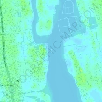
Name: resort topographic map, elevation, terrain.
Location: resort, Cherthala, Alappuzha, Kerala, India (9.80321 76.32671 9.80447 76.32725)
Average elevation: 4 m
Minimum elevation: -1 m
Maximum elevation: 12 m
Other topographic maps
Click on a map to view its topography, its elevation and its terrain.
Ernakulam district
The Ernakulam district covers an area of 3,068 km2 (1,185 sq mi) on the Western Coastal Plains of India. It is surrounded by the Thrissur District to the north, the Idukki District to the east, Alappuzha and Kottayam districts to the south and the Laccadive Sea to the west. The Anamalais occupy a large part of…
Average elevation: 201 m
Kottayam
Kottayam has an average elevation of 3 metres (9.8 ft) above sea level. and is situated in the basin of the Meenachil River and in the basin of the Vembanad backwaters, which are formed from several streams in the Western Ghats in Idukki district. According to the division of places in Kerala based on…
Average elevation: 19 m
Kasaragod district
The district is the northernmost district of the State of Kerala. Kasargod is located at 12°30′N 75°00′E / 12.5°N 75.0°E / 12.5; 75.0. It has an average elevation of 19 metres (62 feet). Ranipuram or Madathumala (1016m) peak is the highest peak in the Kasargod district of Kerala, located in…
Average elevation: 127 m
Kozhikode district
Kozhikode district is bordered by the districts of Kannur and Mahé (Puducherry) to the north, Wayanad to the east, and Malappuram to the south. The Arabian Sea lies to the west and Western Ghats stretches towards east. Vavul Mala, a 2,339 m high peak situated on the trijunction of Kozhikode, Malappuram, and…
Average elevation: 295 m
Angamoozhy
Angamoozhy is geographically a high-range area (Malanadu) situated in the south eastern part of Kerala and very close to the Western ghats mountain ranges. It has an average elevation of 18 m (59 ft) above sea level.
Average elevation: 233 m
Ponkunnam
India > Kerala > Kanjirappally
Ponkunnam is a census town in Kerala, India, part of Kottayam district under Kanjirappally taluk. Ponkunnam literally means golden mountain (ponn = gold, kunn = mountain). Nearby towns are Kanjirappalli, Pampady , Manimala and Pala. This part of Kerala is famous for its fertile land and rubber plantations. It…
Average elevation: 83 m
Shoranur
India > Kerala > Ottappalam
Shoranur is located at 10°46′N 76°17′E / 10.77°N 76.28°E / 10.77; 76.28. It has an average elevation of 49 metres (160 feet).
Average elevation: 47 m