
Abrămuț topographic map
Interactive map
Click on the map to display elevation.
About this map
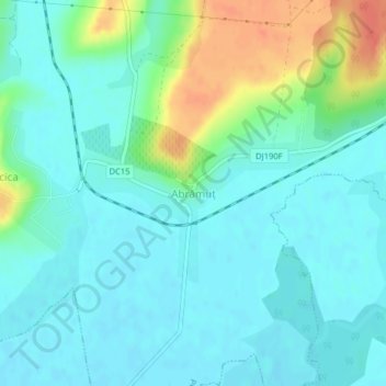
Name: Abrămuț topographic map, elevation, terrain.
Location: Abrămuț, Petreu, Bihor, 417015, Romania (47.31689 22.24048 47.32896 22.26854)
Average elevation: 133 m
Minimum elevation: 120 m
Maximum elevation: 173 m
Other topographic maps
Click on a map to view its topography, its elevation and its terrain.