
Abram topographic map
Interactive map
Click on the map to display elevation.
About this map
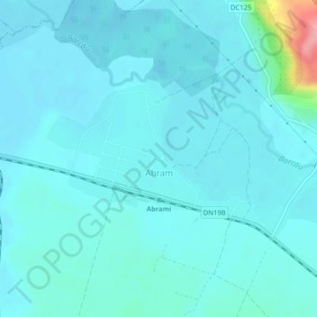
Name: Abram topographic map, elevation, terrain.
Location: Abram, Bihor, 417005, Romania (47.31178 22.36737 47.32414 22.39038)
Average elevation: 140 m
Minimum elevation: 128 m
Maximum elevation: 235 m
Other topographic maps
Click on a map to view its topography, its elevation and its terrain.