
Golden Valley County topographic map
Interactive map
Click on the map to display elevation.
About this map
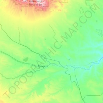
Name: Golden Valley County topographic map, elevation, terrain.
Location: Golden Valley County, Montana, United States (46.04445 -109.65426 46.75153 -108.77776)
Average elevation: 1,276 m
Minimum elevation: 995 m
Maximum elevation: 2,615 m
Other topographic maps
Click on a map to view its topography, its elevation and its terrain.
Chapman Peak
United States > Montana > Glacier County
Chapman Peak (9,411 feet (2,868 m)) is located in the Livingston Range, Glacier National Park in the U.S. state of Montana. Chapman Peak is situated along the Continental Divide. The mountain is named for Robert H. Chapman, one of the US Geological Survey topographers who worked on mapping Glacier Park between…
Average elevation: 2,175 m
Crazy Mountains Historical Marker
United States > Montana > Wheatland County
Average elevation: 1,315 m
Garnet
United States > Montana > Granite County
In First Chance Gulch in western Montana, the town is located 11 miles up the Garnet Range Road, in mountains and forest. The town is at approximately 6,000 feet (1,800 m) elevation. The nearest city is Missoula, approximately 20 miles (32 km) to the west. The closest city to the east is Butte, about 100 miles…
Average elevation: 1,758 m
Wild Horse Island
United States > Montana > Lake County
The island was formed by the Cordilleran Glacier, giving the island a varying topography. Its shores are 2,900 feet (880 m) above sea level. The glacier caused the six summits in the center of the island, ranging in heights between 3,277 and 3,745 feet (999 and 1,141 m), to be formed into rôche moutonnée,…
Average elevation: 916 m
Lake McDonald
United States > Montana > Flathead County
Lake McDonald is the largest lake in Glacier National Park. It is located at 48°35′N 113°55′W / 48.583°N 113.917°W / 48.583; -113.917 in Flathead County in the U.S. state of Montana. Lake McDonald is approximately 10 miles (16 km) long, and over a mile (1.6 km) wide and 472 feet (130 m) deep,…
Average elevation: 1,209 m
West Glacier
United States > Montana > Flathead County
The community, heavily dependent on tourism, has a small permanent population that expands significantly during the summer tourist season; most area businesses are likewise seasonal—including the 18-hole golf course—and are primarily geared towards travelers. The elevation is 3,169 feet (966 m).
Average elevation: 1,201 m