
壽豐鄉 topographic map
Interactive map
Click on the map to display elevation.
About this map
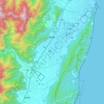
Name: 壽豐鄉 topographic map, elevation, terrain.
Location: 壽豐鄉, 花蓮縣, 974, 臺灣 (23.73126 121.44110 23.94826 121.61127)
Average elevation: 394 m
Minimum elevation: -3 m
Maximum elevation: 2,483 m
Other topographic maps
Click on a map to view its topography, its elevation and its terrain.