
평창군 topographic map
Interactive map
Click on the map to display elevation.
About this map
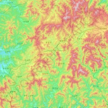
Name: 평창군 topographic map, elevation, terrain.
Location: 평창군, Gangwon, Coreia do Sul (37.26677 128.24372 37.82095 128.76523)
Average elevation: 657 m
Minimum elevation: 146 m
Maximum elevation: 1,548 m
Other topographic maps
Click on a map to view its topography, its elevation and its terrain.
Gangwon
Coreia do Sul > Gangwon > 춘천시 > 봉의동
Gangwon, 모수물길, 봉의동, 춘천시, Gangwon, 24267, Coreia do Sul
Average elevation: 95 m