
Hareidlandet topographic map
Interactive map
Click on the map to display elevation.
About this map
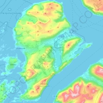
Name: Hareidlandet topographic map, elevation, terrain.
Location: Hareidlandet, Hareid, Møre og Romsdal, Noruega (62.24859 5.80674 62.42516 6.11439)
Average elevation: 174 m
Minimum elevation: 0 m
Maximum elevation: 1,031 m
Other topographic maps
Click on a map to view its topography, its elevation and its terrain.