
Nordland topographic map
Interactive map
Click on the map to display elevation.
About this map
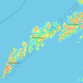
Name: Nordland topographic map, elevation, terrain.
Location: Vestvågøy, Nordland, Noruega (67.78442 13.00369 68.54098 14.18959)
Average elevation: 31 m
Minimum elevation: -1 m
Maximum elevation: 1,083 m
Other topographic maps
Click on a map to view its topography, its elevation and its terrain.