
Vestvågøya topographic map
Interactive map
Click on the map to display elevation.
About this map
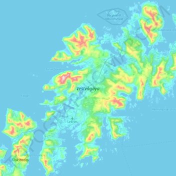
Name: Vestvågøya topographic map, elevation, terrain.
Location: Vestvågøya, Vestvågøy, Nordland, Noruega (68.05714 13.46012 68.34761 14.16971)
Average elevation: 62 m
Minimum elevation: -3 m
Maximum elevation: 948 m
Other topographic maps
Click on a map to view its topography, its elevation and its terrain.