
Sila topographic map
Interactive map
Click on the map to display elevation.
About this map
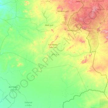
Name: Sila topographic map, elevation, terrain.
Location: Sila, Chad (10.91972 19.88900 13.05900 22.97528)
Average elevation: 544 m
Minimum elevation: 398 m
Maximum elevation: 1,220 m
Other topographic maps
Click on a map to view its topography, its elevation and its terrain.
Missou
Chad > Logone Occidental > Koutou Mare
Missou, Koutou Mare, Logone Occidental, Chad
Average elevation: 396 m
Sangaria
Chad > Hadjer-Lamis > Guitté > Sangaria
Sangaria, Guitté, Hadjer-Lamis, Chad
Average elevation: 284 m
Moundou
Chad > Logone Occidental > Moundou
Moundou, Logone Occidental, 1234, Chad
Average elevation: 438 m
Bissam Koyana Adji
Chad > Hadjer-Lamis > Bissam Koyana Adji
Bissam Koyana Adji, Hadjer-Lamis, Chad
Average elevation: 284 m