
隆林各族自治县 topographic map
Interactive map
Click on the map to display elevation.
About this map
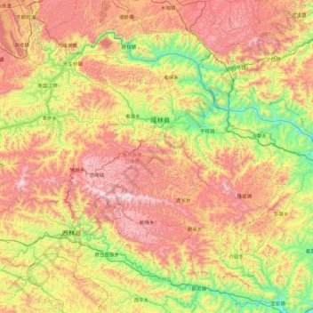
Name: 隆林各族自治县 topographic map, elevation, terrain.
Location: 隆林各族自治县, 百色市, 广西壮族自治区, 中国 (24.37227 104.82048 24.99890 105.68896)
Average elevation: 1,036 m
Minimum elevation: 378 m
Maximum elevation: 1,883 m
Other topographic maps
Click on a map to view its topography, its elevation and its terrain.