
伶站瑶族乡 topographic map
Interactive map
Click on the map to display elevation.
About this map
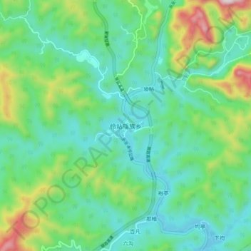
Name: 伶站瑶族乡 topographic map, elevation, terrain.
Location: 伶站瑶族乡, 百色市, 广西壮族自治区, 中国 (24.12744 106.55502 24.20744 106.63502)
Average elevation: 444 m
Minimum elevation: 232 m
Maximum elevation: 1,058 m
Other topographic maps
Click on a map to view its topography, its elevation and its terrain.