
冲绳市 topographic map
Interactive map
Click on the map to display elevation.
About this map
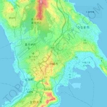
Name: 冲绳市 topographic map, elevation, terrain.
Location: 冲绳市, 冲绳县 / 沖繩縣, 日本 (26.27432 127.77217 26.42175 127.86782)
Average elevation: 36 m
Minimum elevation: 0 m
Maximum elevation: 199 m
Other topographic maps
Click on a map to view its topography, its elevation and its terrain.