
柳川市 topographic map
Interactive map
Click on the map to display elevation.
About this map
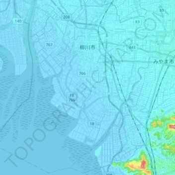
Name: 柳川市 topographic map, elevation, terrain.
Location: 柳川市, 福冈县, 日本 (33.06741 130.31806 33.19659 130.47628)
Average elevation: 3 m
Minimum elevation: -6 m
Maximum elevation: 126 m
Other topographic maps
Click on a map to view its topography, its elevation and its terrain.