
澀川市 topographic map
Interactive map
Click on the map to display elevation.
About this map
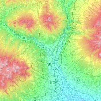
Name: 澀川市 topographic map, elevation, terrain.
Location: 澀川市, 群马县, 日本 (36.44857 138.88065 36.59201 139.16934)
Average elevation: 516 m
Minimum elevation: 102 m
Maximum elevation: 1,367 m
Other topographic maps
Click on a map to view its topography, its elevation and its terrain.