
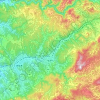
瑞浪市 topographic map
Interactive map
Click on the map to display elevation.
About this map
Name: 瑞浪市 topographic map, elevation, terrain.
Location: 瑞浪市, 岐阜县, 中部地方, 日本 (35.28766 137.19136 35.47473 137.35242)
Average elevation: 348 m
Minimum elevation: 98 m
Maximum elevation: 812 m
Other topographic maps
Click on a map to view its topography, its elevation and its terrain.