
福知山市 topographic map
Interactive map
Click on the map to display elevation.
About this map
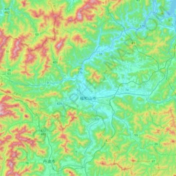
Name: 福知山市 topographic map, elevation, terrain.
Location: 福知山市, 京都府, 日本 (35.16061 134.91709 35.46973 135.32514)
Average elevation: 218 m
Minimum elevation: -1 m
Maximum elevation: 814 m
Other topographic maps
Click on a map to view its topography, its elevation and its terrain.