
Make a donation
Gear up for your next adventure:
As an Amazon Associate, this site earns from qualifying purchases at no extra cost to you.
South Pole topographic map
Click on the map to display elevation.
Make a donation
Gear up for your next adventure:
As an Amazon Associate, this site earns from qualifying purchases at no extra cost to you.
South Pole
The Geographic South Pole is located on the continent of Antarctica, although this has not been the case for all of Earth's history because of continental drift. It sits atop a featureless, barren, windswept and icy plateau at an altitude of 2,835 m (9,301 ft) above sea level, and is located about 1,300 km (810 mi) from the nearest open sea at the Bay of Whales. The ice is estimated to be about 2,700 m (8,900 ft) thick at the Pole, so the land surface under the ice sheet is actually near sea level.
Make a donation
Gear up for your next adventure:
As an Amazon Associate, this site earns from qualifying purchases at no extra cost to you.
About this map
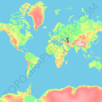
Name: South Pole topographic map, elevation, terrain.
Location: South Pole (-90.01000 -0.01000 -89.99000 0.01000)
Average elevation: 429 m
Minimum elevation: -30 m
Maximum elevation: 6,542 m
Make a donation
Gear up for your next adventure:
As an Amazon Associate, this site earns from qualifying purchases at no extra cost to you.
Other topographic maps
Click on a map to view its topography, its elevation and its terrain.
England
England's topography is characterized by a diverse landscape that transitions from low-lying plains to rugged uplands. In the north and west, the terrain is dominated by mountain ranges such as the Pennines, often referred to as the "backbone of England," and the Lake District, which includes Scafell Pike, the…
Average elevation: 55 m
United Kingdom
The United Kingdom (UK) boasts a diverse topography, ranging from rugged highlands to gentle lowlands. In Scotland, the Highlands dominate the northern and western regions, featuring mountainous terrains with peaks like Ben Nevis, the UK's highest point at 1,345 meters (4,413 feet). The Central Lowlands,…
Average elevation: 42 m
Indonesia
Indonesia's topography is as varied as its expansive archipelago, marked by rugged mountain ranges, volcanic activity, and vast lowland plains. The majority of its major islands are mountainous, with some of the highest peaks rising above 16,000 feet (4,877 meters), such as Puncak Jaya in Papua. These…
Average elevation: 81 m
Make a donation
Gear up for your next adventure:
As an Amazon Associate, this site earns from qualifying purchases at no extra cost to you.
Romania
Romania's topography is a harmonious blend of mountains, hills, and plains, each contributing to the country's diverse landscape. The country is divided into several distinct geographical regions: the Carpathian Mountains, the Transylvanian Plateau, the Moldavian Plateau, and the Danube River Basin. The…
Average elevation: 355 m
India
India's topography is a tapestry of diverse terrains, each contributing to the country's unique geographical identity. In the north, the majestic Himalayas form a formidable barrier, with towering peaks like Kangchenjunga reaching elevations of 8,586 meters (28,169 feet), making it the highest point in India.…
Average elevation: 1,017 m
Iran
Iran's topography is diverse and dominated by rugged mountain ranges, which define much of its landscape. To the west, the Zagros Mountains stretch from the northwest to the southeast, with many peaks surpassing 10,000 feet (3,048 meters) in elevation. These mountains form a rugged barrier between Iran's…
Average elevation: 786 m
Germany
Germany's topography is remarkably diverse, showcasing a blend of lowlands, uplands, and mountainous regions. In the north, the North German Plain extends across vast stretches of flat, fertile land, which supports extensive agriculture, particularly wheat and dairy farming. This area is characterized by…
Average elevation: 237 m
Make a donation
Gear up for your next adventure:
As an Amazon Associate, this site earns from qualifying purchases at no extra cost to you.
United States
The topography of the United States is characterized by diverse and dynamic landscapes that vary widely across the country. In the east, rolling hills and low mountains transition into the Appalachian Mountains, featuring peaks that generally reach around 6,000 feet (1,829 meters). Moving westward, the terrain…
Average elevation: 309 m
Florida
Florida's topography is characterized by its predominantly flat landscape, with the highest elevation being Britton Hill at just 345 feet (105 meters) above sea level, making it the lowest high point of any U.S. state. The state is primarily divided into three physiographic regions: the Atlantic Coastal Plain,…
Average elevation: 6 m
Turkey
Turkey's topography is a diverse tapestry of mountains, plateaus, and coastal plains that create a strikingly varied landscape. The country is predominantly characterized by the Anatolian Plateau, a semi-arid highland that stretches across central Turkey, with elevations ranging from 700 to 2,000 meters. This…
Average elevation: 487 m
Make a donation
Gear up for your next adventure:
As an Amazon Associate, this site earns from qualifying purchases at no extra cost to you.
Poland
Poland's topography is characterized by a diverse landscape that transitions from the Baltic Sea's sandy beaches in the north to mountainous regions in the south. The northern coastline features sand dunes and is indented by spits and lagoons, such as the Hel Peninsula and the Vistula Lagoon. Moving inland,…
Average elevation: 194 m
Sweden
Sweden's topography is a diverse tapestry shaped by ancient geological processes and glacial activity. In the west, the Scandinavian Mountains form a natural border with Norway, featuring peaks like Kebnekaise, the country's highest point at approximately 2,097 meters. Moving eastward, the terrain transitions…
Average elevation: 163 m
Finland
Much of the geography of Finland is a result of the Ice Age. The glaciers were thicker and lasted longer in Fennoscandia compared with the rest of Europe. The eroding effects have contributed to a mostly flat landscape in Finland, characterized by hills. However, in the northern regions, including areas…
Average elevation: 201 m
Netherlands
The Netherlands is renowned for its exceptionally flat terrain, with approximately 26% of its land lying below sea level. This low-lying landscape is characterized by extensive polders—tracts of land reclaimed from the sea and protected by an intricate system of dikes and canals. The western coastline is…
Average elevation: 251 m
Make a donation
Gear up for your next adventure:
As an Amazon Associate, this site earns from qualifying purchases at no extra cost to you.
Greece
Greece's topography is predominantly mountainous, with approximately 80% of its terrain consisting of mountains or hills, making it one of the most mountainous countries in Europe. The Pindus mountain range, often referred to as the "spine of Greece," runs through the center of the mainland from northwest to…
Average elevation: 170 m
Lebanon
Lebanon's topography is characterized by a series of parallel, longitudinal regions running north to south. Along the western edge, a narrow coastal plain stretches the length of the country, widest near Tripoli at approximately 6.5 kilometers, and narrowing to about 1.5 kilometers near Juniyah. This plain…
Average elevation: 638 m
Italy
Italy's topography is characterized by its striking contrast of mountainous regions and coastal plains, offering some of the most varied landscapes in Europe. The northern boundary is dominated by the Alps, which rise dramatically with peaks exceeding 13,000 feet (3,962 meters), creating a rugged frontier with…
Average elevation: 293 m
Scotland
Scotland's topography is a tapestry of rugged mountains, rolling hills, and expansive coastlines. The Highlands, occupying the northern and western regions, are characterized by towering peaks such as Ben Nevis, the UK's highest at 1,345 meters, and deep glens carved by ancient glaciers. The Grampian…
Average elevation: 36 m
Make a donation
Gear up for your next adventure:
As an Amazon Associate, this site earns from qualifying purchases at no extra cost to you.
Dubai Emirate
Dubai's topography is characterized by its location within the Arabian Desert, featuring predominantly flat, sandy terrain interspersed with unique geological formations. The city's landscape is highlighted by fine, white sands composed mainly of crushed shell and coral. To the east, salt-crusted coastal…
Average elevation: 64 m
Texas
Texas showcases a diverse and expansive topography that spans approximately 268,000 square miles (694,117 Km²), making it the second-largest state in the United States. The landscape ranges from the arid deserts of West Texas, characterized by broad valleys and mesas, to the rolling hills of the Texas Hill…
Average elevation: 518 m
Bengaluru
India > Karnataka > Bangalore North
Bengaluru (formerly Bangalore) is situated in the southeastern part of Karnataka, India, within the Bengaluru Urban district. It lies at an elevation of approximately 900 meters (3,000 feet) above sea level, on the Deccan Plateau. This elevated position gives the city a moderate climate, with temperatures…
Average elevation: 881 m
Make a donation
Gear up for your next adventure:
As an Amazon Associate, this site earns from qualifying purchases at no extra cost to you.
Israel
Israel's topography is strikingly diverse, encompassing a variety of landscapes within its relatively small area of approximately 8,522 square miles (22,072 Km²). The coastal plain stretches along the Mediterranean Sea, characterized by sandy shores and fertile land that supports extensive agriculture,…
Average elevation: 410 m
Spain
Spain's topography is marked by a striking diversity, characterized primarily by its elevated central plateau known as the Meseta Central, which rises between 2,000 and 2,500 feet (610 to 762 meters) above sea level. This vast highland is surrounded by several mountain ranges, including the Pyrenees to the…
Average elevation: 331 m
Louisiana
The higher and contiguous hill lands of the north and northwestern part of the state have an area of more than 25,000 square miles (65,000 km2). They consist of prairie and woodlands. The elevations above sea level range from 10 feet (3 m) at the coast and swamp lands to 50–60 feet (15–18 m) at the prairie…
Average elevation: 39 m
Ukraine
Ukraine's topography is characterized by a striking contrast of features across its vast landscape. The country predominantly consists of fertile plains and steppes, especially in the central and southern regions, where elevations typically range from sea level to around 600 meters (1,969 feet) above sea…
Average elevation: 183 m
Make a donation
Gear up for your next adventure:
As an Amazon Associate, this site earns from qualifying purchases at no extra cost to you.
New South Wales
New South Wales (NSW), located on Australia's eastern seaboard, boasts a diverse topography that significantly influences its landscapes and ecosystems. The state's eastern edge is dominated by a narrow coastal plain, featuring regions such as the Illawarra and Shoalhaven near Nowra, characterized by rolling…
Average elevation: 154 m
Pennsylvania
Pennsylvania's topography is characterized by its rich diversity, ranging from the rugged Appalachian Mountains in the south to the flatlands of the northern plateau. The state's elevation varies significantly, with the highest point being Mount Davis at approximately 3,213 feet (979 meters) and the lowest at…
Average elevation: 340 m
New York
New York City's topography is a fascinating blend of varied elevations and unique landscapes, reflecting its diverse geography across five boroughs. Situated at the confluence of the Hudson and East Rivers, the city primarily features low-lying terrain, with the average elevation hovering around sea level.…
Average elevation: 19 m
Make a donation
Gear up for your next adventure:
As an Amazon Associate, this site earns from qualifying purchases at no extra cost to you.
Norway
Norway's topography is defined by its rugged and varied terrain, shaped by ancient geological processes and glacial activity. Dominating the landscape are the Scandinavian Mountains, which run through the country and include peaks like Galdhøpiggen, the highest in Northern Europe at 2,469 meters (8,100 feet).…
Average elevation: 143 m
Vietnam
Due to differences in latitude and the marked variety in topographical relief, Vietnam's climate tends to vary considerably for each region. Vietnam is a country located in the tropics, however Northern Vietnam, including Hanoi, is considered a subtropical region by Köppen climate classification. During the…
Average elevation: 173 m
Saudi Arabia
The main topographical feature is the central plateau which rises abruptly from the Red Sea and gradually descends into the Nejd and toward the Persian Gulf. On the Red Sea coast, there is a narrow coastal plain, known as the Tihamah, parallel to which runs along an imposing escarpment. The southwest province…
Average elevation: 551 m
Make a donation
Gear up for your next adventure:
As an Amazon Associate, this site earns from qualifying purchases at no extra cost to you.
North Carolina
North Carolina features a diverse topography that can be divided into three distinct regions: the Coastal Plain, the Piedmont, and the Appalachian Mountains. The Coastal Plain, which occupies the eastern part of the state, is characterized by flat and gently sloping land, with elevations typically less than…
Average elevation: 163 m
Michigan
Michigan's topography is characterized by a diverse landscape that transitions from flat plains to rugged hills. The state comprises two peninsulas, with the Upper Peninsula showcasing more pronounced elevation changes, including its highest point, Mount Arvon, which rises to 1,979 feet (603 meters). In…
Average elevation: 259 m
Egypt
Egypt's topography is marked by a striking contrast between its arid desert regions and the fertile Nile River Valley. The majority of the country, approximately two-thirds, is covered by the vast Western Desert, characterized by undulating sand dunes, stony plateaus, oases such as Siwa and the Qattara…
Average elevation: 272 m
Australia
Australia's topography is characterized by vast, low-lying plains interspersed with notable highland regions. The Western Plateau, encompassing much of the continent's interior, is a flat expanse punctuated by isolated ranges such as the MacDonnell and Musgrave Ranges, as well as iconic formations like Uluru.…
Average elevation: 35 m
Make a donation
Gear up for your next adventure:
As an Amazon Associate, this site earns from qualifying purchases at no extra cost to you.
Japan
Japan's topography is dominated by rugged, mountainous terrain, with over four-fifths of its landmass consisting of mountains. The country's volcanic origins contribute to the striking landscape, with towering peaks and active volcanoes, including the iconic Mount Fuji, which rises to 12,388 feet (3,776…
Average elevation: 58 m
Denmark
Denmark's topography is predominantly characterized by low-lying, gently undulating terrain, with an average elevation of about 31 meters (102 feet) above sea level. The landscape is largely shaped by glacial activity from the last Ice Age, resulting in features such as moraines, outwash plains, and fjords.…
Average elevation: 30 m
California
California's topography is characterized by a remarkable diversity that includes expansive mountain ranges, deep valleys, and vast deserts. The Sierra Nevada mountains dominate the eastern part of the state, with peaks such as Mount Whitney rising to 14,494 feet (4,418 meters), making it the tallest point in…
Average elevation: 929 m
Indiana
The average altitude of Indiana is about 760 feet (230 m) above sea level. The highest point in the state is Hoosier Hill in Wayne County at 1,257 feet (383 m) above sea level. The lowest point at 320 feet (98 m) above sea level is in Posey County, where the Wabash River meets the Ohio River. The resulting…
Average elevation: 226 m
Make a donation
Gear up for your next adventure:
As an Amazon Associate, this site earns from qualifying purchases at no extra cost to you.
New Jersey
New Jersey's topography is characterized by a diverse landscape that ranges from coastal plains to rolling hills and rugged mountains. The state features a predominantly low elevation along its eastern coastline, where major cities like Newark and Jersey City are located. This coastal lowland, which includes…
Average elevation: 72 m
Chennai
Chennai is located on the southeastern coast of India in the northeastern part of Tamil Nadu on a flat coastal plain known as the Eastern Coastal Plains with an average elevation of 6.7 m (22 ft) and highest point at 60 m (200 ft). Chennai's soil is mostly clay, shale and sandstone. Clay underlies most of the…
Average elevation: 8 m
Tennessee
Tennessee features a diverse and varied topography characterized by its distinct regions, which include the Appalachian Mountains, the Central Basin, and the Gulf Coastal Plain. The state’s highest point is Clingmans Dome, rising to about 6,643 feet (2,025 meters) above sea level, while the lowest point is…
Average elevation: 233 m
Tamil Nadu
The annual rainfall of the state is about 945 mm (37.2 in) of which 48 per cent is through the northeast monsoon, and 32 per cent through the southwest monsoon. Since the state is entirely dependent on rains for recharging its water resources, monsoon failures lead to acute water scarcity and severe drought.…
Average elevation: 253 m
Make a donation
Gear up for your next adventure:
As an Amazon Associate, this site earns from qualifying purchases at no extra cost to you.
United Arab Emirates
The topography of the United Arab Emirates is marked by a striking contrast between expansive, low-lying desert plains and rugged mountain highlands. Most of the country consists of arid basins and rolling sand dunes that form the northern fringes of the Rub' al Khali (Empty Quarter), blending into coastal…
Average elevation: 85 m
Arkansas
Arkansas's plant life varies with its climate and elevation. The pine belt stretching from the Arkansas delta to Texas consists of dense oak-hickory-pine growth. Lumbering and paper milling activity is active throughout the region. In eastern Arkansas, one can find Taxodium (cypress), Quercus nigra (water…
Average elevation: 156 m
Portugal
Portugal's topography is a diverse tapestry of rugged mountains, rolling plains, and extensive coastlines. In the north, the landscape is predominantly mountainous, with the Serra da Estrela range featuring Torre, the highest peak on mainland Portugal at 1,993 meters. This region is characterized by steep…
Average elevation: 268 m
Kenya
Kenya's climate varies from tropical along the coast to temperate inland to arid in the north and northeast parts of the country. The area receives a great deal of sunshine every month. It is usually cool at night and early in the morning inland at higher elevations.
Average elevation: 717 m
Make a donation
Gear up for your next adventure:
As an Amazon Associate, this site earns from qualifying purchases at no extra cost to you.
Pratas Island
Average elevation: 0 m
Illinois
Though Illinois lies entirely in the Interior Plains, it does have some minor variation in its elevation. In extreme northwestern Illinois, the Driftless Area, a region of unglaciated and therefore higher and more rugged topography, occupies a small part of the state. Southern Illinois includes the hilly areas…
Average elevation: 213 m
Colorado
Colorado's topography is characterized by a diverse range of elevations and landforms, making it one of the most geologically varied states in the U.S. The state is dominated by the Rocky Mountains, which run north to south and include the highest peak in the contiguous United States, Mount Elbert, towering at…
Average elevation: 2,060 m
Make a donation
Gear up for your next adventure:
As an Amazon Associate, this site earns from qualifying purchases at no extra cost to you.
Los Angeles
United States > California > Los Angeles County
Los Angeles is characterized by a diverse and dynamic topography. The city is predominantly situated in a basin bordered by mountain ranges, including the Santa Monica Mountains to the north and the San Gabriel Mountains to the east, with elevations reaching up to about 10,000 feet (3,048 meters) in certain…
Average elevation: 241 m
Brazil
Brazil's topography is diverse and characterized by a range of landforms, from vast lowlands to rugged plateaus and coastal ranges. The Amazon Basin, occupying over 60% of the country, is the largest drainage basin in the world, with flat, expansive terrain that receives immense rainfall, feeding the Amazon…
Average elevation: 368 m
Morocco
In the Rif, Middle and High Atlas Mountains, there exist several different types of climates: Mediterranean along the coastal lowlands, giving way to a humid temperate climate at higher elevations with sufficient moisture to allow for the growth of different species of oaks, moss carpets, junipers, and…
Average elevation: 371 m
Sheffield
Sheffield nestles on the eastern foothills of the Pennines and is sculpted by a dramatic hill-and-valley system formed where five rivers — the Don, Sheaf, Rivelin, Loxley and Porter — converge, producing steep-sided valleys and gritstone ridgelines with much of the urban area built directly onto hillsides…
Average elevation: 168 m
Make a donation
Gear up for your next adventure:
As an Amazon Associate, this site earns from qualifying purchases at no extra cost to you.
Mexico
Mexico's topography is characterized by a remarkable diversity, featuring rugged mountains, expansive plateaus, and lush coastal plains. The Sierra Madre Occidental and Sierra Madre Oriental mountain ranges run parallel to the country's western and eastern coasts, respectively, creating a central highland…
Average elevation: 412 m
France
France's topography presents a rich tapestry of varied landscapes, ranging from expansive plains to towering mountain ranges. In the north and west, the terrain is predominantly composed of flat plains and gently rolling hills, exemplified by the Paris Basin, which offers fertile soils ideal for agriculture.…
Average elevation: 430 m
Sinai Peninsula
Sinai is one of the coldest provinces in Egypt because of its high altitudes and mountainous topographies. Winter temperatures in some of Sinai's cities and towns reach −16 °C (3 °F).
Average elevation: 457 m
Thailand
Thailand comprises several distinct geographic regions, partly corresponding to the provincial groups. The north of the country is the mountainous area of the Thai highlands, with the highest point being Doi Inthanon in the Thanon Thong Chai Range at 2,565 metres (8,415 ft) elevation. The northeast, Isan,…
Average elevation: 156 m
Make a donation
Gear up for your next adventure:
As an Amazon Associate, this site earns from qualifying purchases at no extra cost to you.
Mongolia
Most of the country is hot in the summer and extremely cold in the winter, with January averages dropping as low as −30 °C (−22 °F). A vast front of cold, heavy, shallow air comes in from Siberia in winter and collects in river valleys and low basins causing very cold temperatures while slopes of…
Average elevation: 1,347 m
Costa Rica
Average elevation: 101 m
Iowa
Iowa can be divided into eight landforms based on glaciation, soils, topography, and river drainage. Loess hills lie along the western border of the state, some of which are several hundred feet thick. Northeast Iowa along the Upper Mississippi River is part of the Driftless Area, consisting of steep hills and…
Average elevation: 316 m
Belgium
Belgium's topography is characterized by three distinct regions: the coastal plain in the northwest, the central plateau, and the Ardennes uplands in the southeast. The coastal plain features sand dunes and polders—low-lying tracts of land reclaimed from the sea and protected by dikes. Moving inland, the…
Average elevation: 138 m
Make a donation
Gear up for your next adventure:
As an Amazon Associate, this site earns from qualifying purchases at no extra cost to you.
Georgia
The Greater Caucasus Mountain Range forms the northern border of Georgia. The main roads through the mountain range into Russian territory lead through the Roki Tunnel between Shida Kartli and North Ossetia and the Darial Gorge (in the Georgian region of Khevi). The southern portion of the country is bounded…
Average elevation: 1,102 m
Bucharest
The city has an area of 226 km2 (87 sq mi). The altitude varies from 55.8 m (183.1 ft) at the Dâmbovița bridge in Cățelu, southeastern Bucharest and 91.5 m (300.2 ft) at the Militari church. The city has a roughly round shape, with the centre situated in the cross-way of the main north–south/east-west…
Average elevation: 82 m
Alps
The altitude and size of the range affect the climate in Europe; in the mountains, precipitation levels vary greatly and climatic conditions consist of distinct zones. Wildlife such as ibex live in the higher peaks to elevations of 3,400 m (11,155 ft), and plants such as edelweiss grow in rocky areas in lower…
Average elevation: 526 m
Morgantown
United States > West Virginia > Monongalia County
During the 1970s, the U.S. Department of Transportation built an experimental driverless personal rapid transit system in the city, citing the area's variable seasonal climate and geographic elevations as factors in testing the technology's viability. The Morgantown Personal Rapid Transit (PRT) has been in use…
Average elevation: 335 m
Make a donation
Gear up for your next adventure:
As an Amazon Associate, this site earns from qualifying purchases at no extra cost to you.
Mississippi
Mississippi is entirely composed of lowlands, the highest point being Woodall Mountain, at 807 ft (246 m) above sea level, in the northeastern part of the state. The lowest point is sea level at the Gulf Coast. The state's mean elevation is 300 ft (91 m) above sea level.
Average elevation: 74 m
Vermont
The topography and climate make sections of Vermont subject to large-scale flooding. Incidents include the Great Vermont Flood of 1927, which killed 84 and damaged much of the state's infrastructure, the flood of 1973, which covered many of the state's roads in the southeast, and Tropical Storm Irene in 2011,…
Average elevation: 348 m
San Diego
United States > California > San Diego County
The climate in San Diego, like most of Southern California, often varies significantly over short geographical distances, resulting in microclimates. In San Diego, this is mostly because of the city's topography (the Bay, and the numerous hills, mountains, and canyons). Frequently, particularly during the "May…
Average elevation: 125 m
Make a donation
Gear up for your next adventure:
As an Amazon Associate, this site earns from qualifying purchases at no extra cost to you.
Philippines
The Philippines is an archipelago of approximately 7,641 islands, with a total land area of about 300,000 square kilometers. The terrain is predominantly mountainous, with narrow coastal plains and valleys. The highest peak is Mount Apo on Mindanao, reaching 2,954 meters (9,692 feet) above sea level. Other…
Average elevation: 33 m
South Africa
South Africa's topography is characterized by a high central plateau, known as the Highveld, which lies at elevations between 1,200 and 1,800 meters (3,937 to 5,906 feet) above sea level. This plateau is encircled by the Great Escarpment, a prominent mountainous feature that includes the Drakensberg Mountains,…
Average elevation: 221 m
Iceland
The highest elevation for Iceland is listed as 2,110 m (6,923 ft) at Hvannadalshnúkur (64°00′N 16°39′W).
Average elevation: 158 m
Exeter
United Kingdom > England > Devon
The city of Exeter was established on the eastern bank of the River Exe on a ridge of land backed by a steep hill. It is at this point that the Exe, having just been joined by the River Creedy, opens onto a wide flood plain and estuary which results in quite common flooding. Historically this was the lowest…
Average elevation: 56 m
Make a donation
Gear up for your next adventure:
As an Amazon Associate, this site earns from qualifying purchases at no extra cost to you.
Make a donation
Gear up for your next adventure:
As an Amazon Associate, this site earns from qualifying purchases at no extra cost to you.
Make a donation
Gear up for your next adventure:
As an Amazon Associate, this site earns from qualifying purchases at no extra cost to you.
Hungary
Average elevation: 259 m
West Virginia
West Virginia is located entirely within the Appalachian Region, and the state is almost entirely mountainous, giving the reason for the nickname The Mountain State and the motto Montani Semper Liberi ("Mountaineers are always free"). The elevations and ruggedness drop near large rivers like the Ohio River or…
Average elevation: 430 m
Bologna
Italy > Emilia-Romagna > Bologna
Bologna is situated on the edge of the Po Plain at the foot of the Apennine Mountains, at the meeting of the Reno and Savena river valleys. As Bologna's two main watercourses flow directly to the sea, the town lies outside of the drainage basin of the River Po. The Province of Bologna stretches from the…
Average elevation: 91 m
Make a donation
Gear up for your next adventure:
As an Amazon Associate, this site earns from qualifying purchases at no extra cost to you.
Boone
United States > North Carolina > Watauga County
Boone is located at 36°12′41″N 81°40′7″W / 36.21139°N 81.66861°W / 36.21139; -81.66861 (36.211364, −81.668657) and has an elevation of 3,333 feet (1015.9 m) above sea level. An earlier survey gave the elevation as 3,332 ft and since then it has been published as having an elevation of…
Average elevation: 1,069 m
Boston
United States > Massachusetts > Suffolk County
Boston has an area of 89.63 sq mi (232.1 km2)—48.4 sq mi (125.4 km2) (54%) of land and41.2 sq mi (106.7 km2) (46%) of water. The city's official elevation, as measured at Logan International Airport, is 19 ft (5.8 m) above sea level. The highest point in Boston is Bellevue Hill at 330 ft (100 m) above sea…
Average elevation: 25 m
Houston
United States > Texas > Harris County
Houston is characterized by its predominantly flat topography, sitting at an average elevation of approximately 59 feet (18 meters) above sea level. The city is situated on the Gulf Coastal Plain, which is dissected by a network of bayous that contribute to the region's drainage. This terrain was once covered…
Average elevation: 25 m
Make a donation
Gear up for your next adventure:
As an Amazon Associate, this site earns from qualifying purchases at no extra cost to you.
Iraq
The capital, Ninus or Nineveh, was taken by the Medes under Cyaxares, and some 200 years after Xenophon passed over its site, then mere mounds of earth. It remained buried until 1845, when Botta and Layard discovered the ruins of the Assyrian cities. The principal remains are those of Khorsabad, 16 km (10 mi)…
Average elevation: 633 m
New Hampshire
Average daytime highs are in the mid 70s°F to low 80s°F (24–28 °C) throughout the state in July, with overnight lows in the mid 50s°F to low 60s°F (13–15 °C). January temperatures range from an average high of 34 °F (1 °C) on the coast to overnight lows below 0 °F (−18 °C) in the far north and…
Average elevation: 293 m
New Mexico
Over four–fifths of New Mexico is higher than 4,000 feet (1,250 meters) above sea level. The average elevation ranges from up to 8,000 feet (2,500 meters) above sea level in the northwest, to less than 4,000 feet in the southeast. The highest point is Wheeler Peak at over 13,160 feet (4,011 meters) in the…
Average elevation: 1,687 m
Make a donation
Gear up for your next adventure:
As an Amazon Associate, this site earns from qualifying purchases at no extra cost to you.