
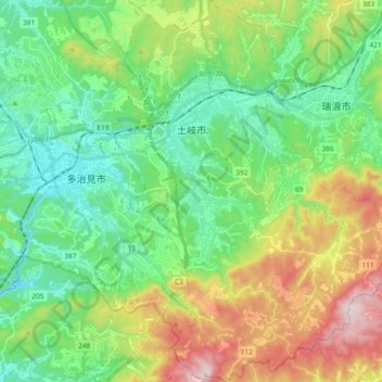
土岐市 topographic map
Interactive map
Click on the map to display elevation.
About this map
Name: 土岐市 topographic map, elevation, terrain.
Location: 土岐市, 岐阜县, 中部地方, 日本 (35.25146 137.14535 35.40382 137.28291)
Average elevation: 274 m
Minimum elevation: 75 m
Maximum elevation: 704 m
Other topographic maps
Click on a map to view its topography, its elevation and its terrain.